The XLAB
Sascha Meinrath
category
Web Development, GIS
Socials
date
10/04/2023

project goals
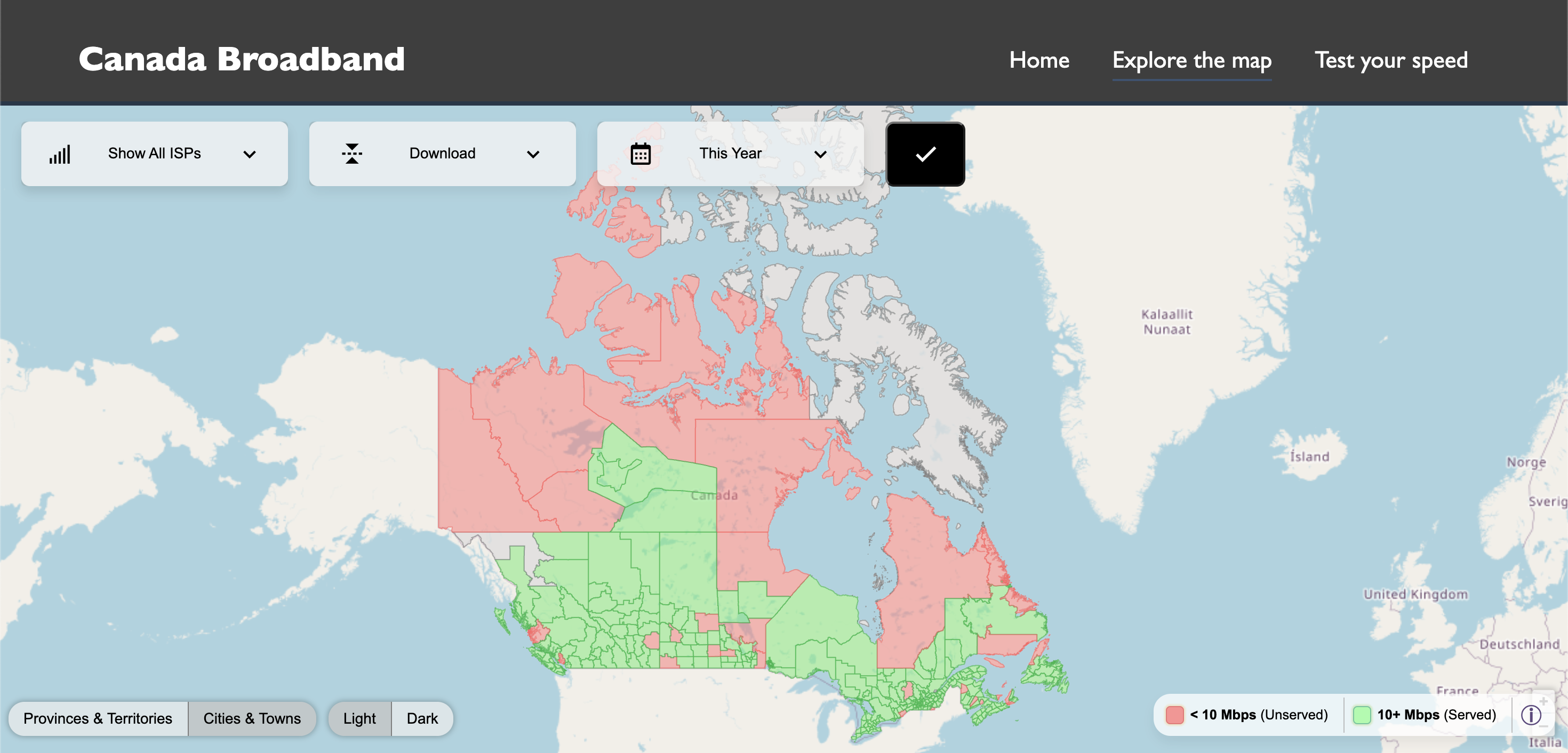
The Canada Broadband project aims to develop a comprehensive GIS mapping application to provide detailed internet data across various provinces and cities in Canada. This application will allow users to access and compare average internet speeds by filtering through parameters such as provider, date, ISP, and upload and download speeds. A key goal of this project is to ensure transparency and accountability in the allocation of government funding. By tracking and displaying where the funds are directed, the project seeks to verify that investments in broadband infrastructure are being utilized in the intended regions and by the specified Internet Service Providers (ISPs).
Establishing a User Friendly Broadband Data Source
The mission of the Canada Broadband project is to enhance digital accessibility and equity across Canada by providing a robust tool for monitoring internet service performance and funding allocation. By leveraging advanced GIS technology, the project aims to empower users with accurate and actionable data, facilitating informed decision-making for both consumers and policymakers. This initiative is committed to promoting transparency, supporting fair distribution of resources, and ultimately contributing to the development of a more connected and digitally inclusive Canada.

project steps
The Canada Broadband project followed a structured approach to ensure the successful development and implementation of the GIS mapping application. The first step involved comprehensive data collection, gathering detailed information on internet speeds, ISPs, and funding allocations across different regions in Canada. Next, this data was integrated into a GIS platform, enabling spatial analysis and visualization. Following this, the development team designed and built the user interface, ensuring it was intuitive and accessible for various users. Extensive testing was conducted to validate the accuracy and functionality of the application. Upon completion of testing, the application was launched in phases, starting with pilot regions to gather user feedback and make necessary adjustments. Finally, a full-scale deployment was carried out, accompanied by training sessions and support materials to assist users in effectively utilizing the application. Regular updates and maintenance were performed to keep the data current and the system running smoothly.
PostgreSQL
To store broadband data and map it to GIS files
GIS
Development of GEOJSON files for provinces and cities
Comparison Feature
Being able to compare two regions or two ISPs
ISP Selection
Mapping data points to 100+ ISPs (Bell, Videotron, TELUS, etc)
project results
Upon completion, the Canada Broadband project will deliver a user-friendly GIS mapping application that offers detailed insights into internet speeds across Canadian provinces and cities. Users will be able to effortlessly compare data based on various criteria, ensuring they have access to up-to-date information about their internet services. The project will also provide a transparent view of government and funding company investments, showcasing whether these funds are being appropriately utilized. As a result, stakeholders will have a valuable resource for assessing the effectiveness of broadband funding, leading to better-informed decisions and potentially improved internet infrastructure and services throughout Canada.


